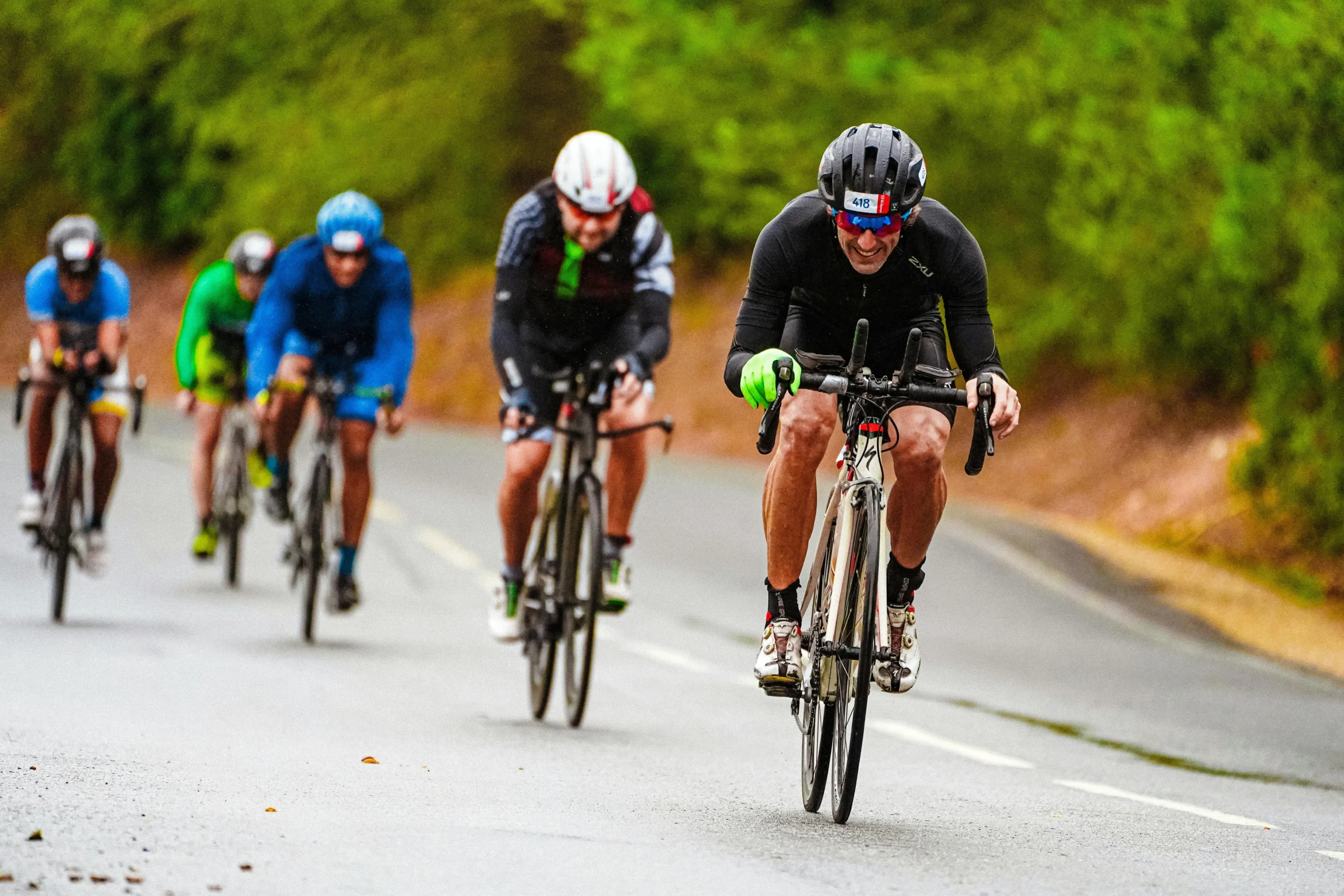
Cycling routes in Calella: discover the Maresme on two wheels
Six routes from Calella for bike lovers (via Wikiloc)
If you’re a cyclist —whether amateur or experienced— and you enjoy discovering coastal, forested, and rural landscapes from the saddle, Calella and its surroundings offer ideal routes for all levels. Below, we present six routes from Wikiloc, including key data and descriptions. We recommend visiting each Wikiloc link to view maps, elevation profiles, and route updates. Please note that conditions may vary depending on terrain and weather.
Easy Cycling Routes:
Route 1: Calella – Sant Pol – Sant Cebrià – Calella
- Distance: 16.24 km
- Technical difficulty: Easy
- Description: The route starts at Plaça del Bunyol in Calella and heads towards the N-II road. It continues along the N-II towards Sant Pol until reaching the Calella roundabout, then enters the Valldenguli stream until crossing under the highway. From there, it follows a winding path in “S” curves leading to a short technical trail that climbs to a main track. Following this track, the route reaches the Camí dels Francesos, descending to the Golinons Valley. Before entering Sant Pol, it makes a sharp turn to climb a path that ascends to a hilltop, descending alongside strawberry greenhouses.After crossing the road between Sant Pol and Sant Cebrià, it follows a trail behind industrial warehouses, leading to the golf course and into Sant Cebrià. Before entering the village, there’s a climb to Coll de l’Era en Mora, connecting to the Hortsavinyà road, then descending back to Calella.
Wikiloc link: Calella – Sant Pol – Sant Cebrià – Calella
Route 2: Calella – Placeta de Sant Andreu – Quatre Camins – Pineda
- Distance: 19.8 km
- Elevation gain: 550 m
- Technical difficulty: Easy
- Description: Starting in Calella, the route follows the road until it turns into a dirt track. It descends to Placeta de Sant Andreu, then continues along narrower paths through forests and trails. One section involves crossing the Pineda stream, which may have water, adding a sense of adventure.
The route returns to Calella via various trails, making it a calm and moderate outing suitable for less experienced riders.
Wikiloc link: Calella – Placeta de Sant Andreu – Pineda
Moderate Cycling Routes:
Route 3: Climb to Brinxar Reservoir – Sant Martí de Montnegre – Orzinelles
- Distance: 46.1 km
- Elevation gain: 1,481 m
- Technical difficulty: Moderate
- Description: This route departs from Calella, climbing via tracks to the Brinxar Reservoir, then continues ascending to Sant Martí de Montnegre. From there, it descends along a trail before reaching two technical sections in Orzinelles (“La Trinxa Full”), offering thrilling and controlled descents. After the downhill, there’s another ascent before a fast descent to Sant Iscle. The route then follows a road to Sant Pol and returns to Calella. Along the way, local wildlife such as deer may be spotted, especially in the wooded areas.
Wikiloc link: Climb to Brinxar Reservoir and Orzinelles
Route 4: Calella – Creu de Canet – Pedra de la Ferradura – Vallgorgina – Olzinelles – Calella
- Distance: 84.3 km
- Elevation gain: 1,442 m
- Technical difficulty: Moderate
- Description: A long and varied ride that includes forest paths, rugged terrain, and scenic wooded sections. The final 25 km pass through lush forests offering picturesque views but also requiring solid biking skills.
It’s a constant up-and-down ride, so good physical fitness is advised. Water sources are scarce, so carrying enough hydration is essential.
Wikiloc link: Calella – Creu de Canet – Vallgorguina – Olzinelles
Route 5: Costa Brava circular: Calella – Blanes – Lloret de Mar – Tossa – Calella
- Distance: 90.52 km
- Elevation gain: 1,189 m
- Technical difficulty: Moderate
- Description: A long route that combines the scenic beauty of the coastline with physical challenges. It includes flat sections near the sea and steeper climbs inland. Enjoy breathtaking views of coves, beaches, and cliffs along the Costa Brava. The first and last 12 km are gentler; the middle section features moderate elevation changes and mixed terrain that is generally rideable and not overly technical.
Wikiloc link: Calella – Blanes – Lloret – Tossa – Calella
Ruta 6: Calella – Hortsavinyà – Quatre Camins – Calella
- Distance: 27.79 km
- Elevation gain: 620 m
- Technical difficulty: Moderate
- Description: Starting on Carrer Amadeu in Calella, the route follows the Passeig de Mar and heads inland along the stream. A steady climb leads to Pla de Sant Andreu. The route continues toward Castellar de l’Índies and the Tres Termes cross, then descends to Hortsavinyà. From there, it heads to Pineda via the Erola hermitage, Coll de Porc, and Quatre Camins, crossing the Pineda stream. It finishes with a return to Calella via local roads or the train station. The ascent is steady with good trail conditions, and the descent offers stunning views and fun sections. It’s a well-marked route with clear exit options.
Wikiloc link: Calella – Hortsavinyà – Calella (La Roser i El Toni)
Sports tourism in Calella: your ideal base for cycling
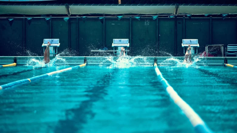
At the Hotel Bernat II, we are committed to sports tourism. Every year, we host athletes, cyclists, swimmers, and fitness enthusiasts seeking a strategic base on the Maresme coast. Our hotel features a buffet specifically adapted to sports diets. Plus, our location —right by the N-II road— allows for quick and easy access to all these routes.
If you’re planning a cycling getaway to Calella, stay with us: relax in comfortable rooms, recharge with a nourishing breakfast, and start your ride from the heart of the town. We invite you to check out the routes on Wikiloc, choose those that match your level, and book your stay at the Hotel Bernat II. Get ready to discover the Maresme on two wheels!